
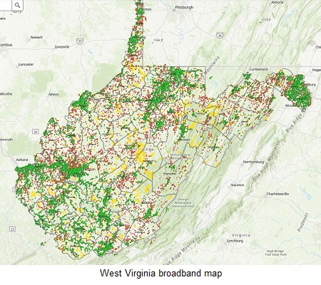
Mountainous West Virginia has released a new map that it claims is the most accurate depiction of broadband availability in that state, reports Herald-Dispatch.com. In an effort to deliver broadband services to its most remote residents, West Virginia can now more easily identify the unserved and underserved areas in need of digital outreach.
“West Virginia continues to identify comprehensive approaches to provide affordable broadband options for our citizens,” stated Senator Bob Plymale. “Our approach has been tying broadband to economic development and improving data to facilitate policy direction and investment. Delegate [Daniel] Linville has made relentless efforts to provide a model for our state and others to follow. I applaud his efforts and pledge to work with him to provide solutions to provide access to broadband.”
The resulting maps were a joint effort by the state and private enterprise, Ookla, which measures internet connection speeds. The project was funded and state grants, with additional financial support from the National Telecommunications and Information Administration, the West Virginia Department of Commerce and state Development Office’s Office of Broadband. Local focus was able to deliver a degree of accuracy missing from previous FCC mapping initiatives.
“This incredibly detailed map provides us the best information we’ve ever had to identify the areas where we need to focus our broadband expansion efforts and resources,” said Linville. “I look forward to sharing our methods with other states and our federal partners.”
Reader Interactions