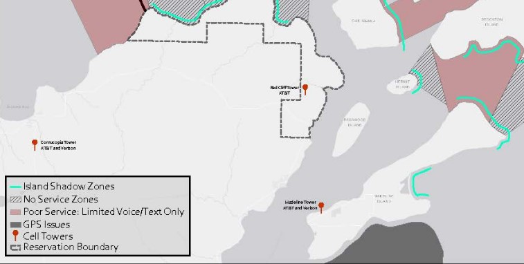
The United States Coast Guard and the Red Cliff Band of Lake Superior Chippewa Indians recently mapped out LTE service coverage for the Apostle Islands to help ensure the safety of residents and visitors.
Located in northern Wisconsin, the Apostle Islands draw hundreds of visitors every summer for kayaking, hiking, and camping along its group of 22 islands in Lake Superior. Although a cell tower was erected earlier this year, cell coverage was reported to be still spotty in areas, putting visitors’ safety at risk.
Theron Rutyna, IT Director for Red Cliff, said, “Real life, on-scene – can you actually make a call? Can you make a 911 call? Can you text? That’s data that we didn’t have.”
According to KBJR-TV, the Coast Guard and Chippewa Indians used mapping software and equipment on AT&T FirstNet network to scan almost 200 nautical miles of operation. Using the data collected, they created a map to show visitor’s and emergency responder’s signal strength across the island.
Kyle Caddotte, Red Cliff Chief of Police said, “This definitely increases the opportunity to respond faster to a more accurate location.”
Rutyna told KBJR that marine radios are still the best way to communicate with the shore or coast guard, but visitors can enjoy using their cell devices knowing where the best cell signals are.


Reader Interactions